NEW USERS PLEASE READ:
Q: How can I get more information about a campground?
A: Click on the colored symbol - an info balloon comes up. Then click on anything underlined in the balloon.
Q: Where can I find an explanation of the symbols, terms and abbreviations you use?
A: There is a legend BELOW the map.
Q: What kinds of campgrounds do you include?
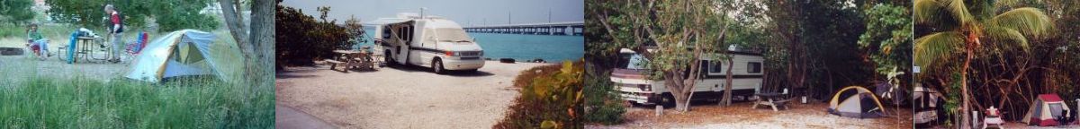
A: We include all Federal, State and local campgrounds in all 50 states - and all Canadian Provinces. We include only public car-accessible family campgrounds with 4 or more campsites. (no backpack-in, boat-in, horse camps or group-only camps). We tell you if you need to take a ferry or if a short walk to the sites is required.
We include all campgrounds whether reservable or not.
We do not include privately-owned campgrounds.
We do not have written directions, we try to have very accurate coordinates to get you there. You will often see direction signs when you get close - follow these.
Q: When I click on any link it keeps opening new tabs/windows - can I change this?
A: When you click any link, it opens in a new tab so that your position on the map is not lost. If your browser keeps opening a whole new window (not just a new tab) you need to change a setting in your browser. Go to tools>options>tabs> and tell it to open new windows and/or pop-ups in a new tab.
Q:What are some of the features of USCAmpgrounds.info?
A: USCAmpgrounds puts all the information you need for that camping road trip in one place! All the public campgrounds in the US and Canadian Provinces - about 12,000 Federal, State, Provincial and Local - all accurately mapped with links to all the information you need. Includes National Park, National Forest, Corps of Engineers, TVA, BLM, State Park, State Forest, State Recreation Areas, County, City and Regional campgrounds, Canadian Provincial Parks, Canadian National Parks and others.
Much of the data came directly from Federal and State government sources. We further verify the coordinate location of each campground for maximum accuracy. Data for each campground consist of coordinates, number of sites, reservations and other facility and RV hook-up information. Phone numbers and web links are provided for further information and reservations.
Q: Why don’t you have privately-owned campgrounds?
A: There are other directory services that focus on privately-owned campgrounds and that are equipped to deal with the advertising and other commercial and competitive concerns of private operations.
Q: What might I expect at different types of campgrounds?
If you are an experienced camper, you pretty much know what to expect of the different types of campgrounds. If not, maybe the below will help. (If you think we have characterized some wrong, please tell us)
NF, NP, CNP: Scenic settings with well developed facilities, few have hook ups for RVs. Some NF do not have drinking water.
BLM, WMA, SF, SFW: Tend to be more rustic, less developed and perhaps not as scenic, very few have hook ups for RVs. Some BLM do not have drinking water.
COE, TVA: Very nicely developed on scenic lakes, excellent facilities, often RV oriented, most have RV hookups, but tents are not out of place.
SP, PP: Very nicely developed, excellent facilities, a variety of activities, often with RV hook ups but tents are well accomodated also.
CP: Very variable, often very RV oriented, tenters may feel out of place. In the mid-west, many small towns have in-town parks with some camping. These are often within walking distance of restaurants, shopping, etc. and many are very nicely developed.
SB: State beaches (mostly in CA) are right on the ocean and tend to accomodate RVs best, tenters may feel exposed and out of place.
Q: Your data indicates that some campgrounds have certain features (eg., flush toilets or electric hookups) and others are blank. Does this mean they don’t have these features?
A: No, it just means we don’t have data on that feature - they may or may not have it. Click on one of the links for details.
Q: How accurate are your campground coordinates and info?
A: These data come from many sources and there are errors as well as changes over time that we do not reflect. There are a number of campground coordinate files out there - often in the form of GPS-POI files. We have found that there are many errors in the even the best available coordinate data (even directly from governmental sources). Therefore, we verify the location of every campground by electronically projecting each campground onto a topo map and looking for indications of a campground at that location. We do not list campgrounds we cannot verify. Our coordinates will always put you on the right road and take you to within 1/5 mile of the campground. From there you may need to rely on signs or other information to find the campground entrance.
Here are the ways we verify and we suggest you use these also where possible to increase your certainty:
- On our map, center and zoom in on the campground then switch the map type to "ArcGIS USGS topo." Often, you will see the campground roads and often the topo map will clearly label the campground (with the campground name in many cases) so you can see how close our coordinates are. If ours are not close enough, double click on the actual campground location as shown on the topo map (to recenter the map) then note the "center" coordinates shown in the lower left hand corner of the map.
- In the google search results (or from a printed or on-line directory), get road directions to the campground and don't use the lat/lon alone for directions.
Be sure to use our google search to get all the info you need about individual campgrounds before you go.
For up-to-the-minute info, phone the number(s) we list or, if you don't have a phone number but know the park name and a town nearby, try dialing 800-free-411 (a free directory service, you will need to listen to some advertising to get the number). This would only work with very developed campgrounds that have a phone on site, e.g., a State Park but usually not a National Forest or BLM campground. If you do call a NF or BLM number, it is probably a general office and, while they will be usually very helpful, you had better call before 4:30 PM.
Q: What should I be careful of in using your data?
A: You need to make sure that the campground is open at the time you want to go there – some are closed seasonally or for budget reasons or for construction and a few are closed permanently and our data may not reflect these situations. You need also to make sure that the campground and its approach roads will accommodate your camping vehicle. Also, if you don’t have reservations, you need to make sure that there are sites. Always call ahead if possible.
Every one of our coordinates is on a road, but some are very minor roads. Depending on what software you use to find your route (Google, iPhone, GPS, etc) it can (rarely) happen that the road the campground is on is not in the GPS database. In this case, your routing software may take you down a road nearby the campground but which does not actually lead into the camground - be sure to follow signs when you can and dont rely totally on computerized directions.
Q: What should I do to avoid problems?
A: You should plan ahead where possible. Get reservations if you can - we have phone numbers and links to reservations systems. At least CALL AHEAD to the campground, we provide phone numbers for most campgrounds in many cases. If you call a National Forest or BLM number, it is probably a general office and, while they will usually be very helpful, you had better call before 4:30 PM and on a weekday.